Mapping existing broadband service is a requirement for states angling for a piece of the roughly $4.2 billion in matching American Recovery and Reinvestment Act funds for high-speed Internet expansion. But with a deadline approaching, states and municipalities have been scrambling to find the data.
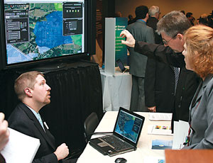
Now, a new tool is available to help. In February, Connected Nation, a Washington, D.C.-based nonprofit dedicated to expanding high-speed Internet access, launched BroadbandStat, a Web-based mapping platform that provides an interactive display of broadband availability and usage within a state, searchable down to a home address.
“The federal stimulus for broadband requires states to submit complete data on usage and coverage, and BroadbandStat facilitates the information that will help states plan for these expansions,” explains Jessica Ditto, communication director for Connected Nation. The U.S. Dept. of Commerce’s National Telecommunications & Information Administration requires each state to have a publicly available broadband GIS map by Feb. 17, 2011, to qualify for related ARRA funds.
Created in partnership with ESRI, a developer of geographic imaging systems technology, the high-speed Internet service mapping site is the first online interactive tool to present a state’s broadband Internet coverage in a publicly available, comprehensive format. It includes data from thousands of resident surveys on Internet usage and needs conducted by Connected Nation, as well as current Internet service provider coverage areas.
The group says in coming months it will launch sites for Alaska, Florida, Illinois, Iowa, Kansas, Michigan, Minnesota, Nevada, Ohio, South Carolina, Texas and Puerto Rico. The first state to go live was Tennessee, at www.connectedtn.org.
“The tool allows providers to see where unserved consumers are located and plan expansions,” says Michael Ramage, executive director, Connected Tennessee. He says the data is of interest to not only state officials and providers planning coverage expansions but also to investors and contractors curious about where projects will be located when the NTIA awards funds this September.
According to Ramage, the Tennessee tool is already delivering. “We had one [Internet service] provider looking at an area about 45 miles north of Nashville,” Ramage says. “Using the tool, they were able to see that there was recent population growth but no service—they had just missed it. Now they are in the engineering phase of a broadband expansion.”


Post a comment to this article
Report Abusive Comment