By Luke Abaffy
A new mobile app uses Apple Maps to tag site drawings onto a shareable map.
By Luke Abaffy
A new mobile app uses Apple Maps to place blueprints on a shareable map.
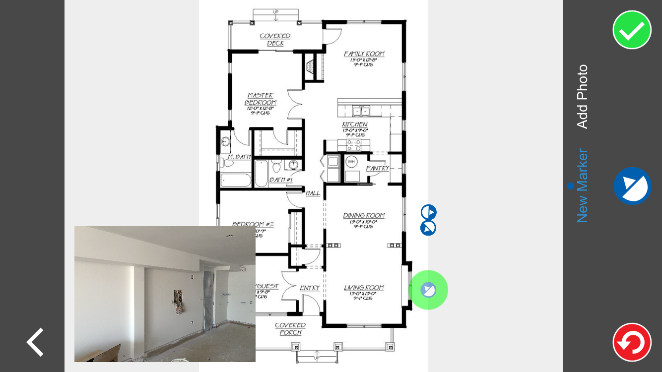
A new mobile application for iOS devices allows users to pin site plans to their location on Earth by integrating with Apple Maps. Then, they can take site photos and make annotations and markups on the plans.
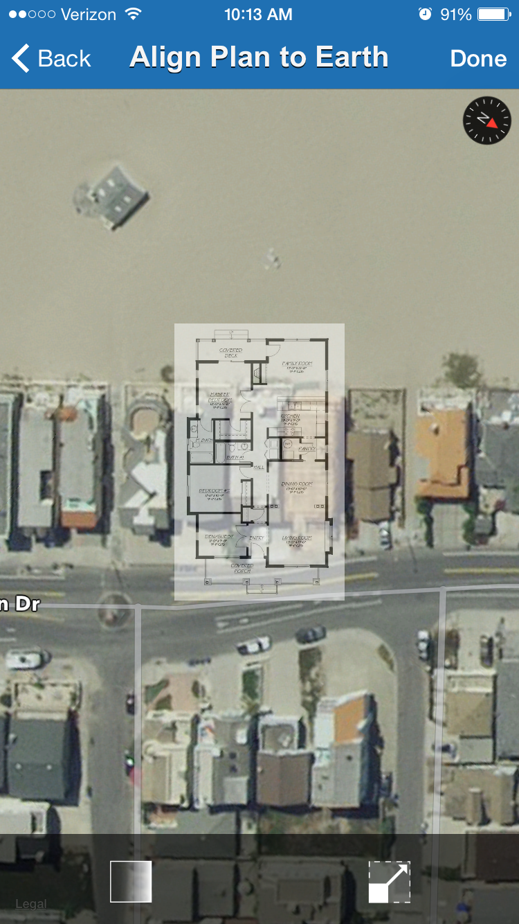
ENR tested Hackensack, N.J.-based EarthCam’s new Site Map Cam app on a residential construction site at Southern California’s Silver Strand Beach.
The app opens up with the option of adding a new building. The next step is to name the building, placing it on Apple Maps via manually inputting the site address or using GPS. The app starts with the plan of the first floor.
The user must upload and align a site plan to its geographic location using Apple Maps. The opacity and size of the site plans can be adjusted.
Once the floor plan is placed, users walk around the site and—this is the important part—add directional markers orienting the photo. When ENR tested it, we had to recalibrate our iPhone 6 to get each marker’s direction precisely correct. Once a marker is set, a photo can be taken and pinned to that location, along with notes and comments.
As construction progresses, users can return to the location of the marker and take an updated photo, overlaying it on the first photo. With the nearly transparent layers, week-byweek site progress becomes evident. However, the app
isn’t foolproof: It won’t alert the user when a picture is being taken from the opposite direction of a specific marker.
The app is free to try, but once the users upload the 51st photo, they will be prompted to sign up for one of three levels of service. They run $4.99 a month for 50 photos, $24.99 for 500 photos and $79.99 for up to 3,000 photos. All levels include EarthCam's Project Archives that archives all site photos in a downloadable web-based archive. EarthCam also offers a more robust version of the app, but it costs $99—meaning, no free trial.


Post a comment to this article
Report Abusive Comment